
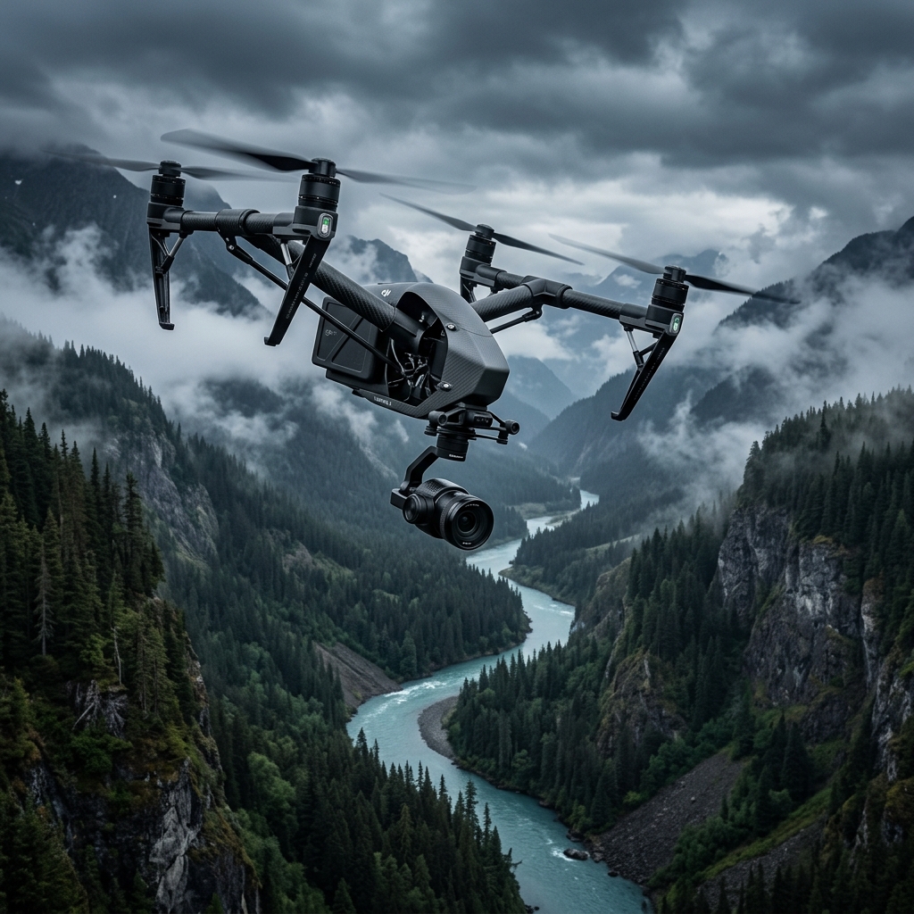
ALT: 280 FT AGL
SIGNAL: OPTIMAL
Alaska's Eyes in the Sky
Professional-grade 8K aerial cinema, centimeter-accurate mapping, and high-fidelity utility inspections statewide.
Clients don't want drone flights.
They want outcomes.
Select your role to see exactly what you get — no jargon, just results.
What Builders want
"Weekly site progress & earthwork reports"
What Insurers want
"Rapid storm-damage roof documentation"
What Realtors want
"Cinematic listing media that closes deals"
What Engineers want
"Survey-grade mapping without boots on ground"
What Municipalitys want
"Infrastructure condition inventory at scale"
Engineered for precision.
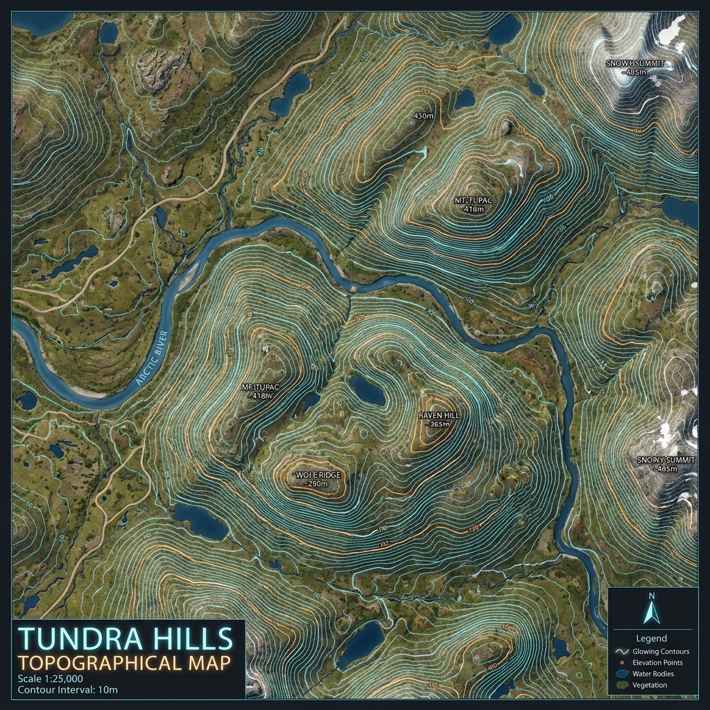
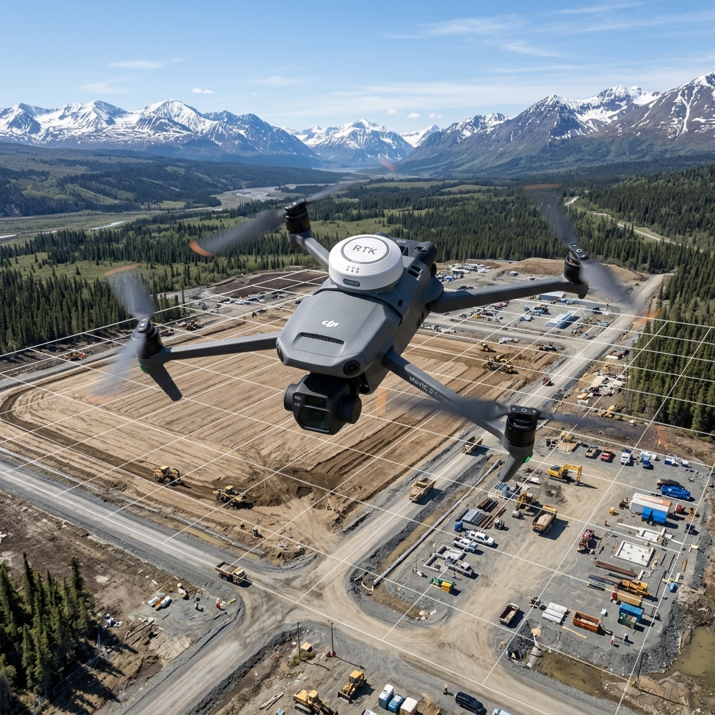
Aerial Mapping
High-density point clouds, orthomosaics, and terrain models for remote sites.
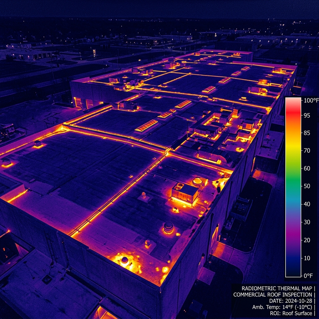
Roof Inspections
Insurance documentation, storm damage, and commercial roof condition reports.
Construction Monitoring
Weekly flights, monthly reports, time-lapse and stakeholder dashboards.
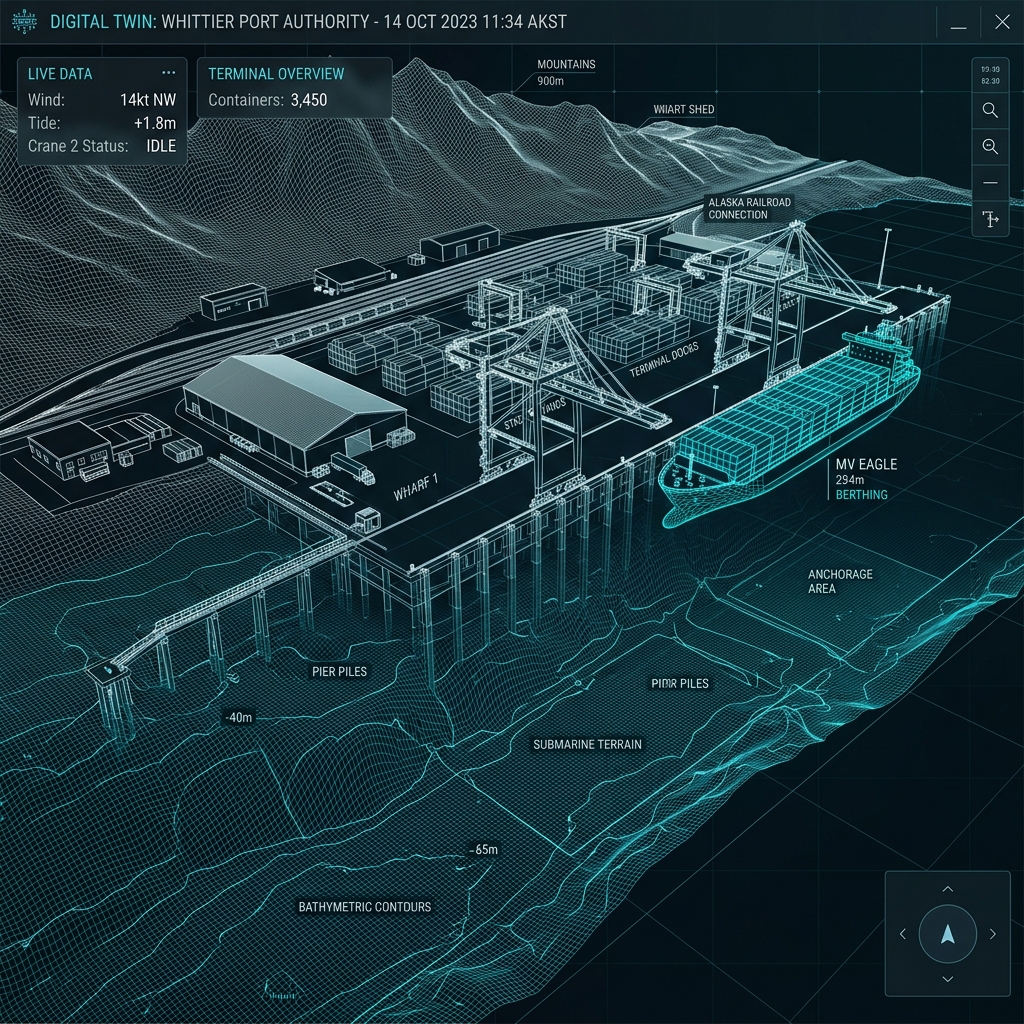
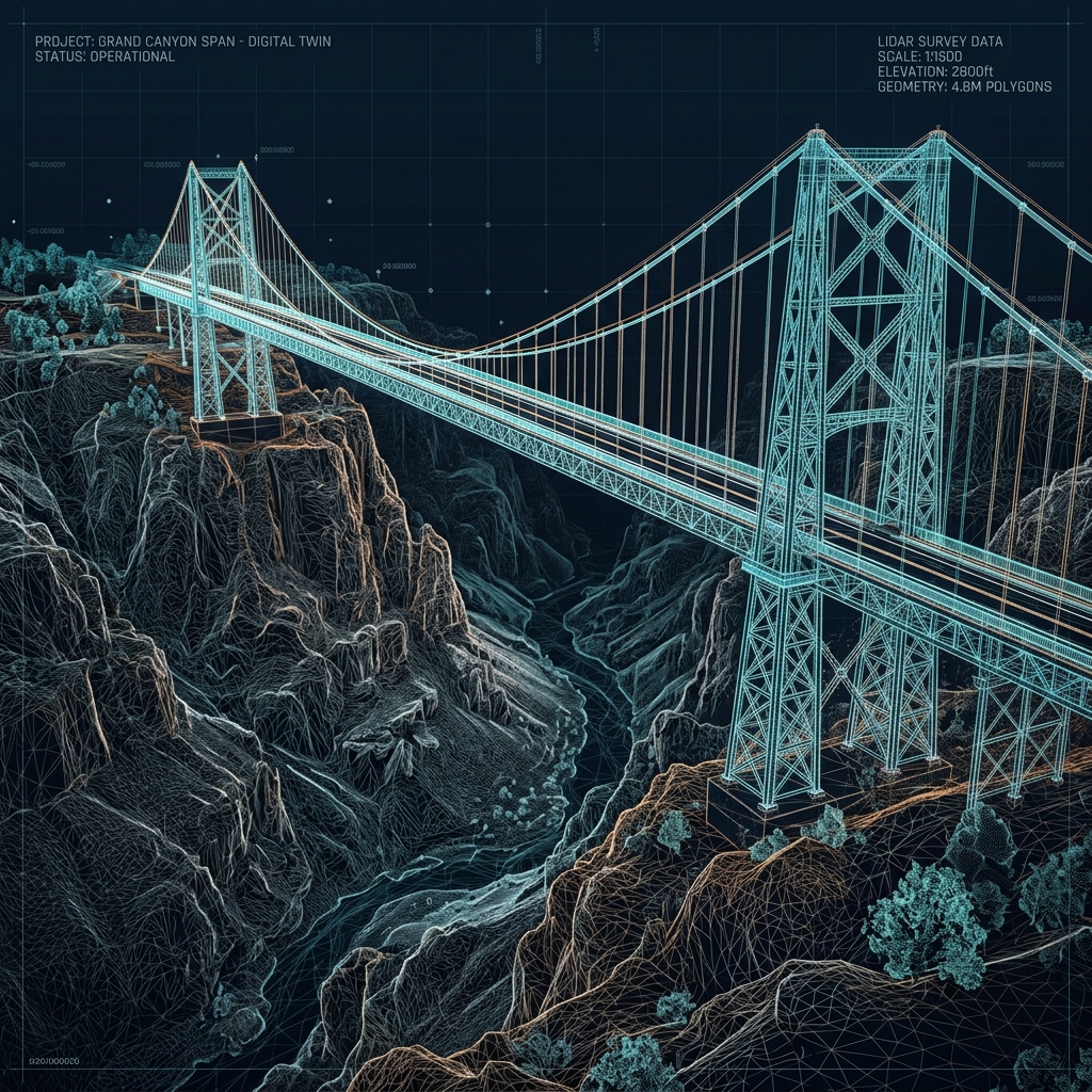
3D Modeling
Reality capture, point clouds, and digital twins for asset documentation.
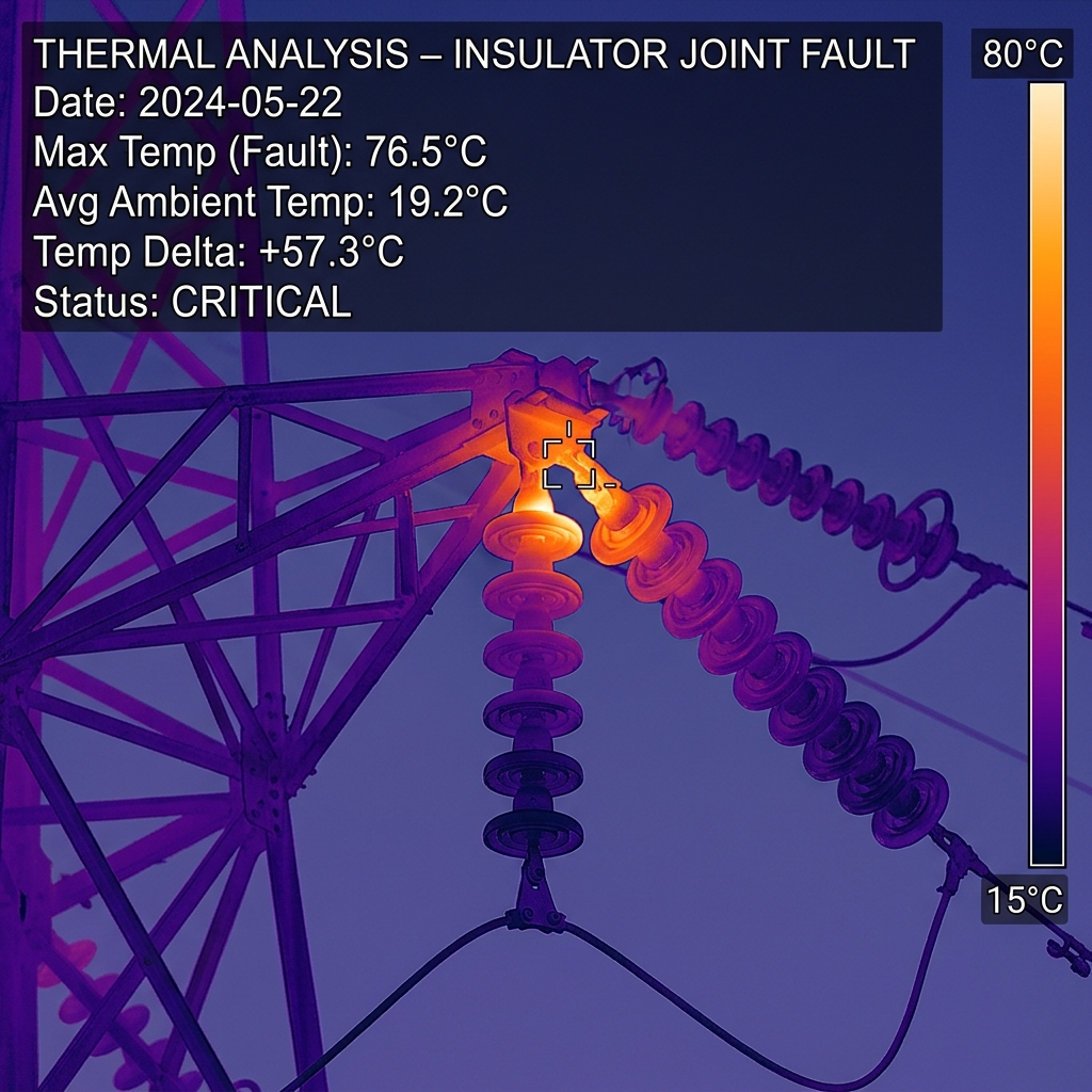
Thermal Imaging
Roof moisture, electrical, solar arrays, and search & rescue support.

Infrastructure Inspection
Bridges, towers, water tanks, powerlines, and industrial facilities.
Cinematography
8K professional-grade aerial cinema w/ centimeter-level RTK positioning, Netflix approved camera & delivery processing.

Survey Support
RTK workflows, ground control, GIS-ready exports, and CAD deliverables.
Built for the operators of Alaska.
From the North Slope to Southeast, our pilots support clients across every major commercial sector — with deliverables tuned for engineers, adjusters, developers, and municipal planners alike.
All industries →From Anchorage to the Arctic Circle.

Precision is not accidental. It is engineered.
Every flight is preceded by rigorous airspace analysis and atmospheric monitoring. We don't just fly — we execute data capture missions with industrial discipline.
Site Calibration
Mission planning, airspace review, weather analysis, and GCP placement for cm-level accuracy.
Flight Operations
FAA-compliant automated acquisition with optimized flight paths and consistent data overlap.
Data Processing
Cloud-based photogrammetry, editing, and human-in-the-loop technical review.
Secure Delivery
Cloud downloads of images, video, maps, point clouds, and PDF inspection reports.
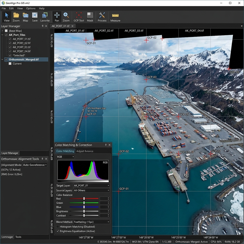 Orthomosaic // 3 cm/px
 Common terms — hover to learn more.
Hardware is a commodity. Judgment in the field is not.
FAA Part 107
Certified pilots and compliant operations statewide.
Fully Insured
$5M general liability — additional insured on request.
Statewide Coverage
Crews mobilize from Anchorage, Fairbanks, and Juneau.
Enterprise Equipment
RTK platforms, radiometric thermal, and survey-grade payloads.
Fast Turnaround
Standard deliverables within 5 business days.
Cloud Delivery
Secure, branded project portals for every engagement.
The altitude your project demands.
Tell us about your site. We respond with a clear scope, fixed pricing, and a flight plan within one business day.
Statewide availability · 24 hr response