Classified Debrief · MSN_LOG // 881-B
Susitna River Crossing.
Energy transmission line clearance survey
TARGET_COORDS // 61.8592° N, 150.0544° W SYSTEM_ACTIVE // LINK_OPT
01 / OBJECTIVE
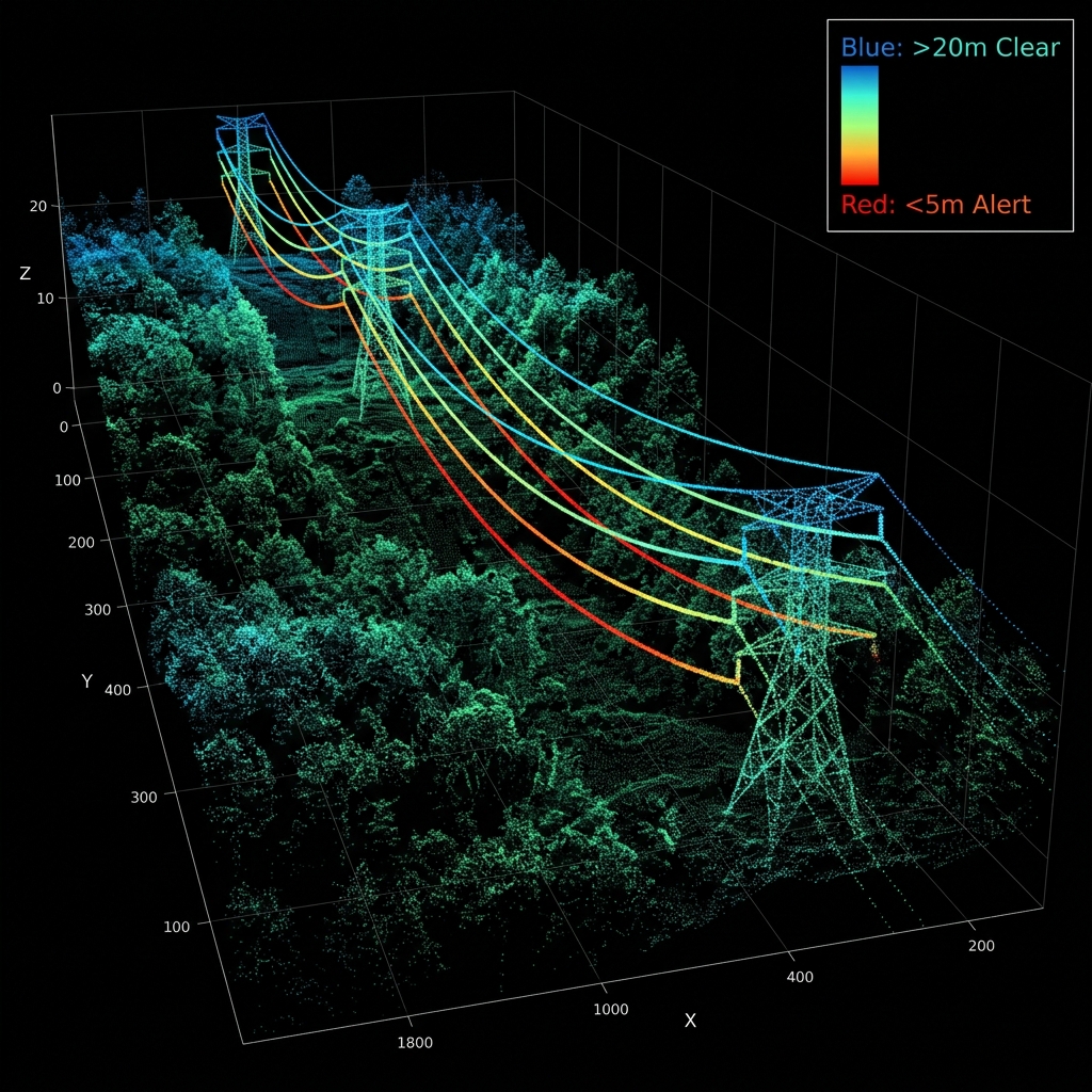
To scan and model conductor sag coordinates and vegetation clearance parameters across a 1.2-mile river crossing span for high-voltage transmission lines.
02 / SOLUTION
Deployed the Matrice 350 RTK in high-accuracy LiDAR sweep mode. Calculated centimeter-accurate elevation models of the conductor lines under active thermal load conditions, mapping wire height offsets from water and trees.
03 / OUTCOMES
Calculated exact catenary curves showing 1.2 meters of safety margin beyond clearance thresholds, pinpointing 4 localized trees requiring vegetation removal before winter freeze.
Mission debrief file
LOG_PARAMETERS
LOCATION Susitna River Basin, AK
COORDINATES 61.8592° N, 150.0544° W
TERRAIN TYPE Dense forest, wetlands, river channels
FLIGHT TIME 184 Minutes total airtime
WEATHER PROFILE Overcast, 8m/s constant wind, -4°C
AIRCRAFT RENDER DJI Matrice 350 RTK
PAYLOAD/SENSOR Zenmuse L2 LiDAR + Emlid Reach RS2+
EXPORTS GENERATED Classified LAS Point Cloud, DTM, Sag Analysis report
DEBRIEF_DECLASSIFIED // ACCESS_GR
RAW LOG METRICS DOWNLOAD_AVAIL
Next Step Operations
Scope a mapping or inspection mission
Get fixed pricing and dispatch flight schedules dynamically for your parcel coordinates.
Start Flight Planner