Utqiagvik Drone Operations.
Mapping sea ice shoreline changes, providing structural insulation checks for arctic buildings, and supporting remote archaeological mapping.
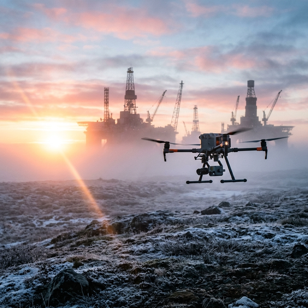 AERIAL VIEW // UTQIAGVIK
 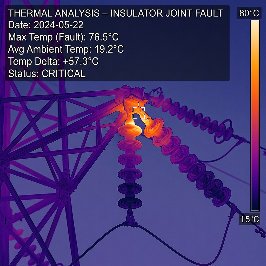 DATA DELIVERABLE // UTQIAGVIK
 Location Data
Top Industries Served
- Environmental Science
- Thermal Building Scan
- Historic Mapping
Core Deliverables
- Orthomosaic Maps (3cm/px)
- LiDAR Terrain Profiles & DTMs
- Thermal Radiometric Scans
- 3D Point Clouds & Meshes
- 4K–8K Cinematic Media
- PDF Inspection Reports
- GIS / CAD-Ready Exports
Local Context
Why Utqiagvik missions require specialized expertise.
Operating commercial UAS in Utqiagvik and the broader Western & Arctic region demands experience with local weather patterns, terrain challenges, and regulatory nuances specific to Alaska's Class B/C/D airspace sectors. Our pilots have flown hundreds of missions in conditions that ground standard commercial operators.
Every Utqiagvik project begins with a custom site survey that accounts for local magnetic declination, wind corridor timing from mountain passes, and coordination with ATC when operating near controlled fields. This is not extra — it's standard for us.
Utqiagvik FAQ
01 How do drone compasses handle high magnetic latitude in Utqiagvik?
+
How do drone compasses handle high magnetic latitude in Utqiagvik?
We utilize dual-antenna RTK heading systems that rely on GPS satellites rather than magnetic compasses.
02 What is your turnaround time for deliverables?
+
What is your turnaround time for deliverables?
Standard deliverables (imagery, orthomosaics, inspection reports) are ready within 5 business days of flight. Rush 48-hour delivery is available for an additional fee.
Also Serving Nearby
Need a flight booked in Utqiagvik?
We specialize in complex, high-precision payloads and remote-site deployments across Western & Arctic Alaska.
COORD: 71.2906° N, 156.7886° W · FAA PART 107 COMPLIANT