Equipment · LiDAR Point Cloud Sensor
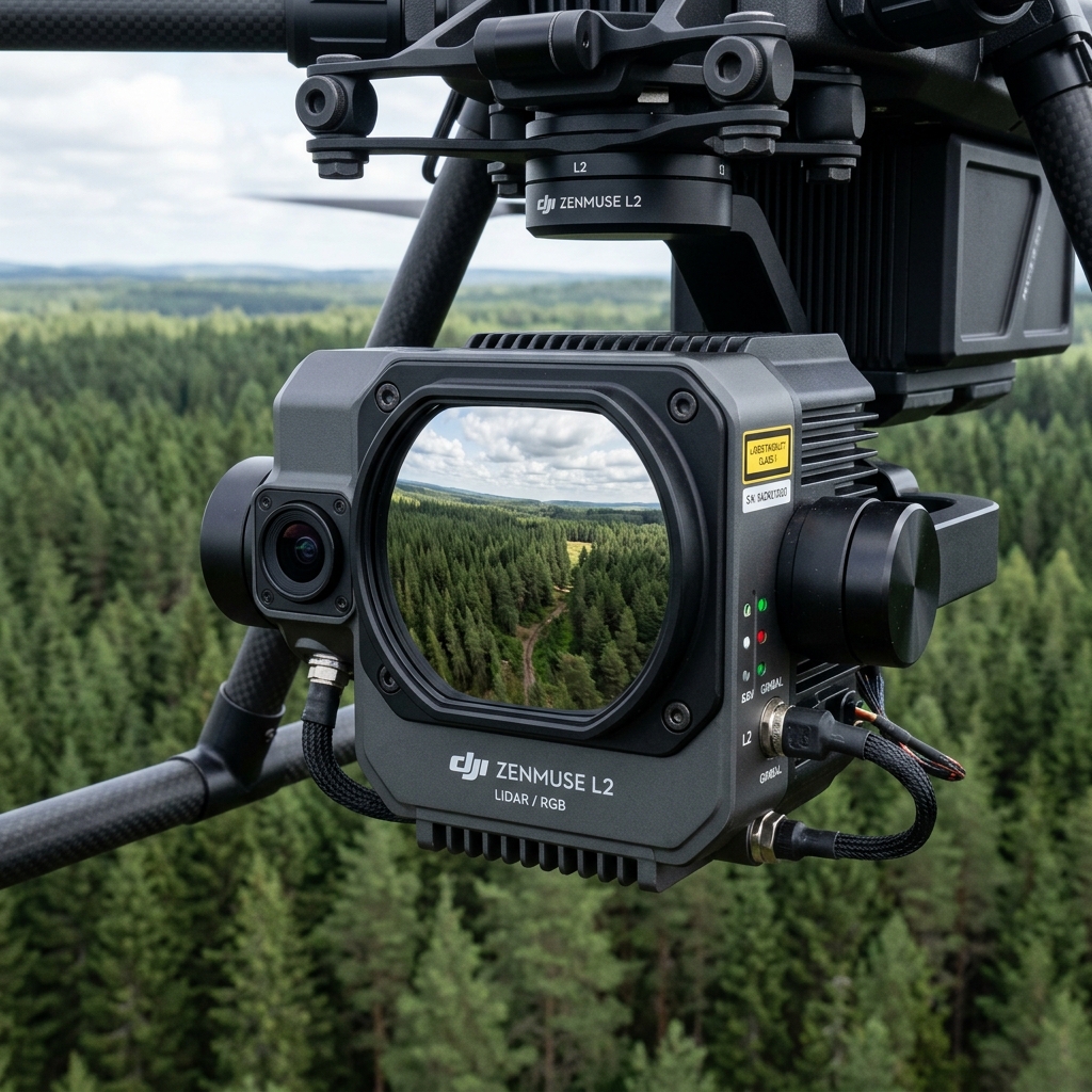
Zenmuse L2 LiDAR Sensor.
Peel back vegetation layers to map the soil below. The Zenmuse L2 shoots up to 5 laser returns per pulse, measuring the bare earth underneath dense tree covers and thick bushes.
 EQUIPMENT PROFILE // ZENMUSE L2 LIDAR SENSOR
 System Capability
Forest inventory scans, coal/gravel volumetric tracking, and utility line sag calculations. Every flight log is recorded dynamically in our mission control ledger to ensure systematic hardware maintenance, FAA compliance, and optimal pilot field dispatch.
Avionics System Specs
Hardware Parameters
Laser Returns Up to 5 returns per pulse
Point Rate 240,000 points/second
Vertical Accuracy 4 cm (Systematic)
Horizontal Accuracy 5 cm (Systematic)
Detection Range 250m @ 10% reflectivity
■ SYSTEM READY // GPS FIXED
OPERATIONAL STATUS: OK
WAIVER: DEPLOYABLE STATEWIDE
Operations Log FAQ
Zenmuse L2 LiDAR Sensor Field Coordination
What is the benefit of 5 laser returns?
The laser beam splits as it hits branches. Multiple returns record the top branches, middle leaves, lower grass, and finally the soil itself.
Deploy our fleet on your next mission
Select target sensors and define your parcel coordinates using our automated flight planner tool.
Launch Flight Planner