Equipment · Compact Survey Mapping
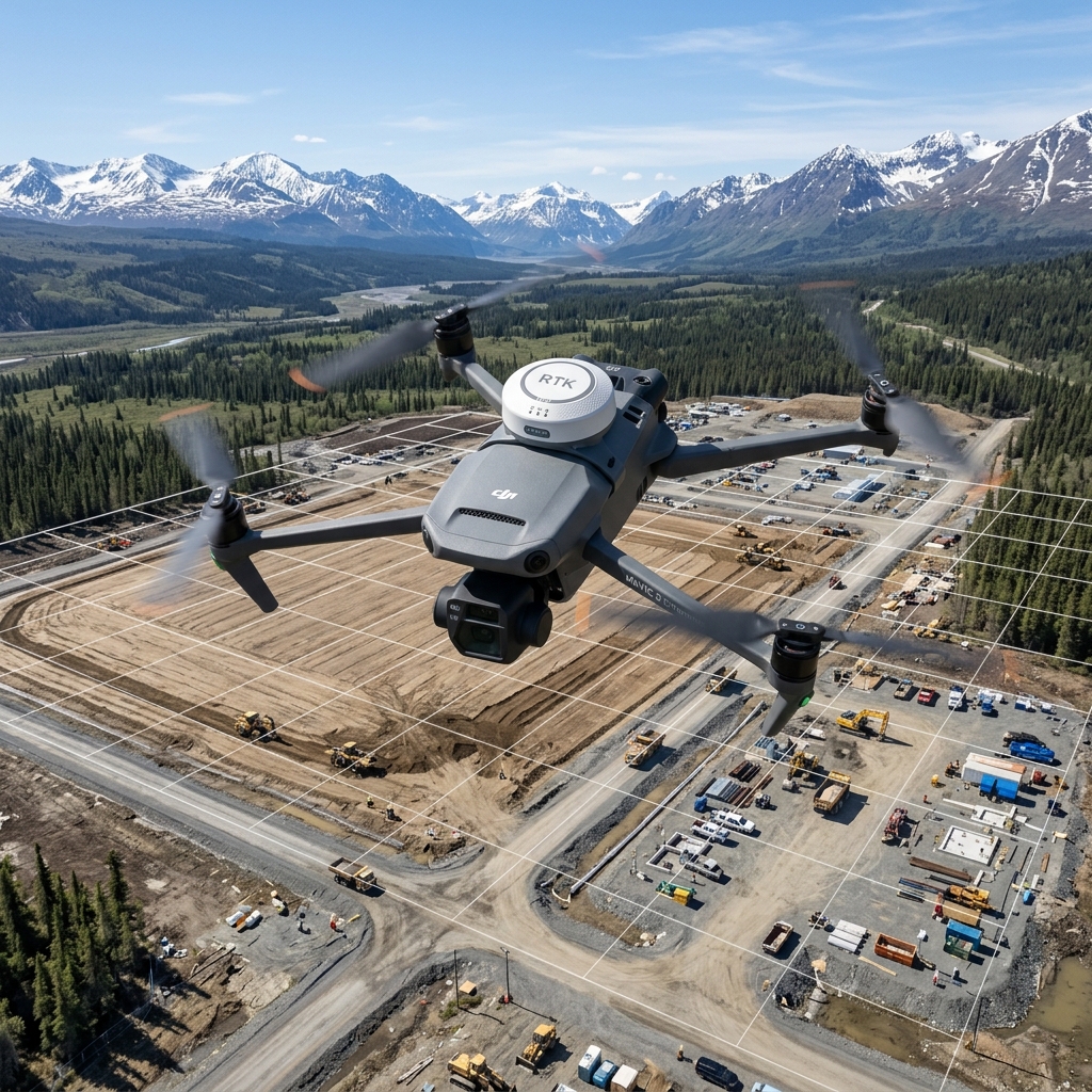
DJI Mavic 3 Enterprise.
Our primary high-efficiency photogrammetry tool. The Mavic 3 Enterprise features a mechanical shutter that eliminates rolling-shutter warp, allowing it to capture detailed site maps at speeds up to 15 m/s.
 EQUIPMENT PROFILE // DJI MAVIC 3 ENTERPRISE
 System Capability
Weekly construction site updates, flat roof inspections, and parcel topography maps. Every flight log is recorded dynamically in our mission control ledger to ensure systematic hardware maintenance, FAA compliance, and optimal pilot field dispatch.
Avionics System Specs
Hardware Parameters
Camera Shutter Mechanical (1/2000s)
Sensor Size 4/3 CMOS, 20 MP
Flight Time 45 Minutes
Weight 915 g (Ultra-portable)
GSD Resolution Down to 0.7 cm/px
■ SYSTEM READY // GPS FIXED
OPERATIONAL STATUS: OK
WAIVER: DEPLOYABLE STATEWIDE
Operations Log FAQ
DJI Mavic 3 Enterprise Field Coordination
Why is the mechanical shutter critical for mapping?
Electronic shutters distort images when flying fast, introducing coordinates calculation errors. The mechanical shutter eliminates this blur completely.
Deploy our fleet on your next mission
Select target sensors and define your parcel coordinates using our automated flight planner tool.
Launch Flight Planner