Classified Debrief · MSN_LOG // MESH-12
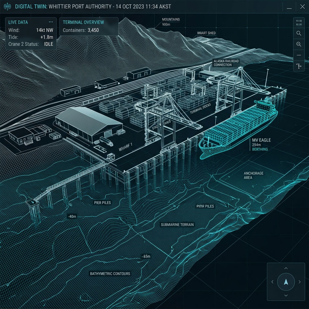
Whittier Port Digital Twin.
Marine ferry terminal structural digital twin
TARGET_COORDS // 60.7731° N, 148.6839° W SYSTEM_ACTIVE // LINK_OPT
01 / OBJECTIVE
Generate a high-fidelity 3D structural model of the marine ferry terminal docks, pilings, and terminal ramps to identify concrete cracks and deterioration.
02 / SOLUTION
Conducted high-density horizontal scans and oblique camera orbits around dock faces, concrete piles, and loading machinery, processing 2,400 raw high-res visuals.
03 / OUTCOMES
Built a sub-centimeter textured digital twin allowing municipal inspectors to annotate structures and track crack expansions remotely from their main Anchorage headquarters.
Mission debrief file
LOG_PARAMETERS
LOCATION Whittier Port, AK
COORDINATES 60.7731° N, 148.6839° W
TERRAIN TYPE Deepwater fjord, concrete dock infrastructure
FLIGHT TIME 215 Minutes airtime
WEATHER PROFILE Partly cloudy, 3m/s wind, 12°C
AIRCRAFT RENDER DJI Matrice 350 RTK + DJI Inspire 3
PAYLOAD/SENSOR Zenmuse P1 45MP Camera + X9-8K Cinema
EXPORTS GENERATED 3D Textured Mesh (.OBJ), photogrammetric digital twin
DEBRIEF_DECLASSIFIED // ACCESS_GR
RAW LOG METRICS DOWNLOAD_AVAIL
Next Step Operations
Scope a mapping or inspection mission
Get fixed pricing and dispatch flight schedules dynamically for your parcel coordinates.
Start Flight Planner